Ha-Ling Peak / Miners Gully
Canmore, Alberta
Type of Site: Hike & Fly Mountain Site (PG)
Total Height: 908m
The above information was made prior to Banff NP opening up to pilots but still contains excellent information for pilots flying in Canmore.

Before taking off
Please contact Alpine Helicopters at 403-678-4802 and communicate your intentions for the day. Good communications with other air users helps to ensure our continued use of flying sites in Canmore and if you’re lucky you may even get a weather report from them.
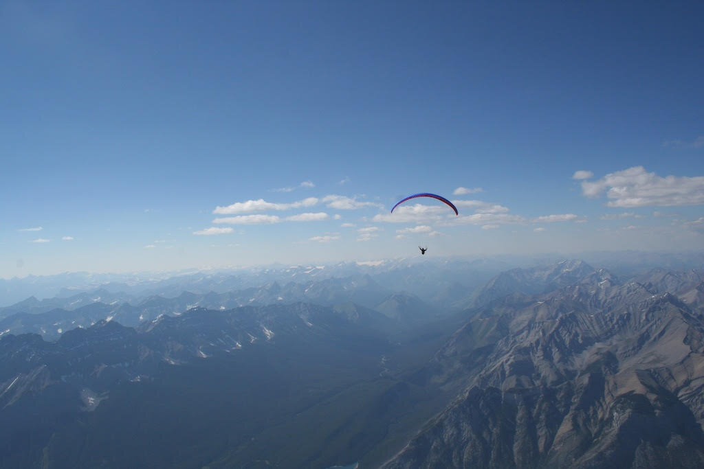
An interesting site many launch directions. Look toward the south side of the valley, the peak to the left with the huge black rock face is Ha Ling. Launch is in the saddle to the east of the westernmost summit block overlooking Whiteman's Gap. It's often a really good place to launch in the morning facing Canmore, the east-facing cliffs work surprisingly well. Additionally, there is a wind sheltered gully to the south of the saddle called Miners Gully, which allows for a SW launch in to a gap flanked by tall rock faces and a direct line for the landing zone. With a calm day, this area is a must do for the hike and flyer.
Access: Follow the signs to the Nordic Centre, keep going as the road turns to dirt, drive past the small lake for about a half K, park at the Goat Creek trailhead on the right, walk across the road up toward the canal, past the little wooden shack, grunt to the top. About 1.5 hours to launch with a fat glider bag.
Launch: Anywhere in the saddle to hiker's right of the peak everybody hikes too. Or, just over the saddle facing the town of Canmore. Both launches are best in the spring when there is still snow, it's a bit mangy for comp-lined gliders at other times of year. The launch facing Canmore is a bit nicer.
As for winds, there's enough thermal action in the morning to make this site our only morning site.
If it's blowing hard in the gap with the lake as you drive through there keep driving and go for a hike. There's occasionally some weird valley winds blowing on the Spray Lakes, be aware that landing in the gap can be sporting--if you fly off the west-facing side and don't immediately hook it up it's likely best to fly through the gap and out over town, that usually works well.
See VIMEO video at the bottom of this page for a look at the launch from Miners Gully and the Quarry Park Landing Zone
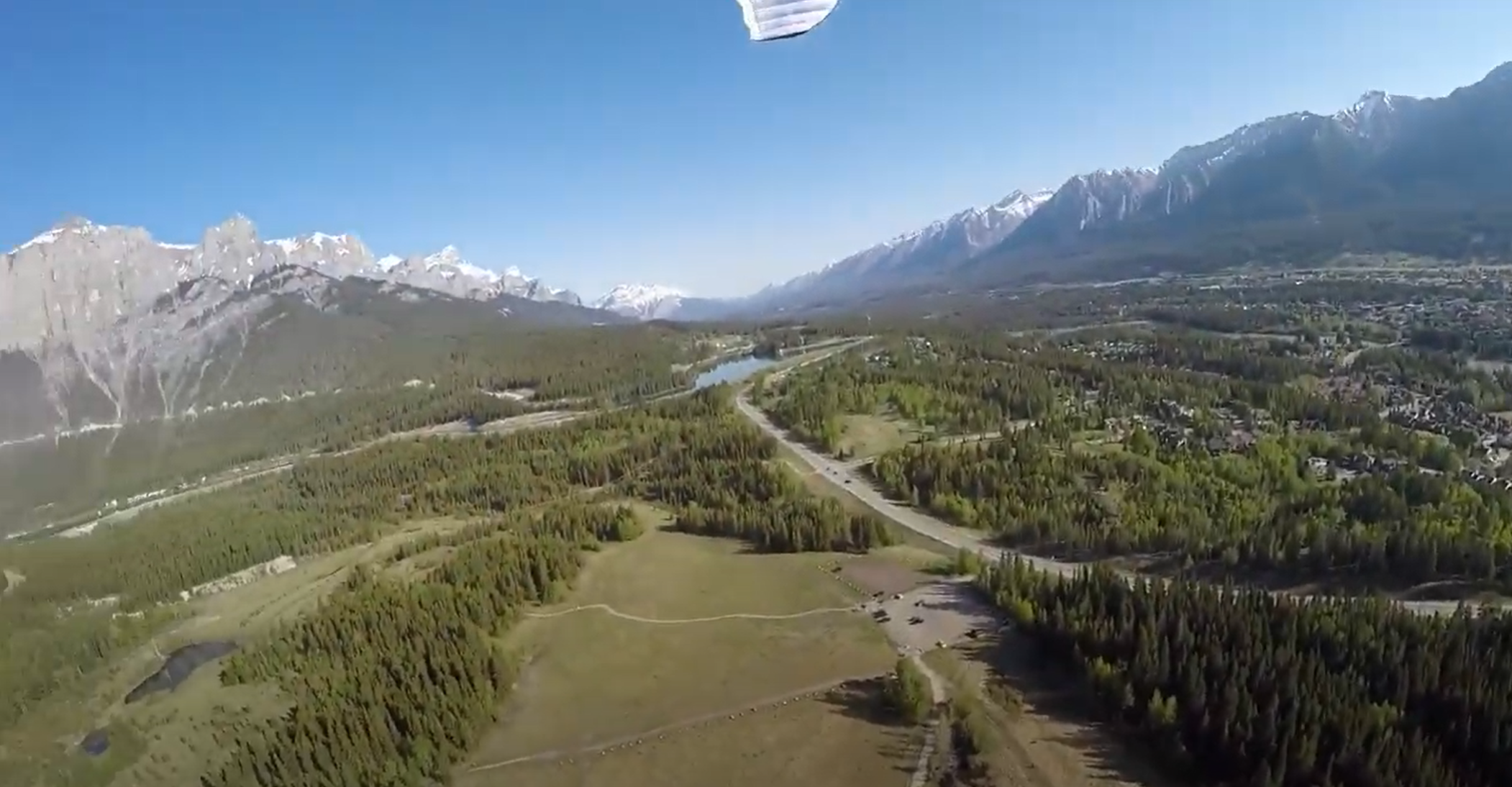
Landing: If you launch to the west then pick one of the big fields. If you launch towards Canmore people land either at Quarry Lake (the little lake on the right before the big reservoir near the Nordic Center) or someplace else.
Airspace: The takeoff is within the Calgary CAE (Class E), extending from 5,800ft to overflying airspace. There are no other airspace concerns. You should pay more mind towards not landing in the national park. The boundary is just west of the Canmore townsite.
XC Options: There is lots of XC potential here, either NW along the Rundle Massif, or SE towards Spray Lakes. This area is notorious for high winds, spiky thermals, and sharp rocks. Be ready for a wild ride, and take care not to land in a National / Provincial Park.

Site Weather Links:
https://weather.gc.ca/city/pages/ab-34_metric_e.html
Additional Links:
http://www.gravsports.com/paragliding%20pages/paragliding_pages.htm
Local Contact:
Brandon Hopkins / ab.hgpg.association@gmail.com